
Garmisch-Partenkirchen
82467 Garmisch-Partenkirchen, Deutschland
Kramer Plateau Path Garmisch Partenkirchen | Map & Parking
The Kramer Plateau Path is one of those trails where the first few meters show why it is so frequently sought after: It connects the proximity to the town with a true mountain atmosphere, remains relatively easy to walk, and still offers wide views of the alpine landscape around Garmisch-Partenkirchen. Official tours describe it as a panoramic path at the foot of the Kramer, with sections that run without significant inclines and can be taken as a circular route or a longer connection to Grainau, depending on the variant. This mix of accessibility, views, and several possible entry points is what makes the Kramer Plateau Path appealing. Those looking for maps, parking, photos, or reviews usually want exactly that: clear orientation, real highlights along the way, and a realistic assessment of whether the tour fits their schedule. The Kramer Plateau Path meets these expectations very well, as it is not only scenically attractive but also practically well documented. ([zugspitz-region.de](https://www.zugspitz-region.de/tour/kramerplateauweg))
Map and Route: How to Navigate the Kramer Plateau Path
When searching for the map of the Kramer Plateau Path, the official tours from the Zugspitz Region and GaPa Tourism are particularly helpful, as they not only describe the path but also provide starting points, route details, and GPX downloads. An official variant starts at the Farchant train station or at the Lanewies P3 parking lot or the parking lot at Pflegersee, leading as a 13.00-kilometer tour to Grainau. Another official loop above Garmisch-Partenkirchen begins at Richard-Strauss-Platz, crosses the Loisach Bridge, and follows Kramerstraße to the plateau hiking trail and back as a 7.11-kilometer circular route. This is important for practical planning because the search term map often does not only refer to a visual overview but also to the question: Where do I start, how long will the route be, and can I shorten it along the way? The official routes provide clear answers to exactly that. ([zugspitz-region.de](https://www.zugspitz-region.de/tour/kramerplateauweg))
The route descriptions also show that the Kramer Plateau Path can be used flexibly. Those who only want to take a scenic walk can choose a short section and return the same way later. Those with more time can extend the path to include Pflegersee, the Kriegergedächtniskapelle, or a detour to the mountain hut. The official description even mentions that the tour can easily be shortened or extended. This is crucial for many search queries related to Kramer Plateau Path map, Garmisch, and route, as it means one does not have to improvise on-site. It is also particularly useful that the path is described in the official material as well-marked. This makes navigation easy despite several connection options, as long as one briefly looks at the chosen entry version beforehand. ([zugspitz-region.de](https://www.zugspitz-region.de/tour/kramerplateauweg))
Another advantage of the map is the context of the path within its surroundings. The Kramer Plateau Path runs along the southern slope of the Kramer and offers views of the Ester, Karwendel, and Wetterstein mountain ranges. The official GaPa page also emphasizes that the Kriegergedächtniskapelle, Schmölzersee, and Pflegersee are located in close proximity. So, when planning with a map, one quickly sees: The path is not an isolated walk but a connecting piece between several excursion destinations. This makes it ideal for guests who not only want to walk but also want to stop, look, and take a break along the way. ([zugspitz-region.de](https://www.zugspitz-region.de/tour/kramerplateauweg))
Parking and Access: The Best Starting Points Around Garmisch-Partenkirchen
Regarding parking, the Kramer Plateau Path offers several realistic options, depending on how long the hike is intended to be. For the circular tour above Garmisch-Partenkirchen, the official tour names the parking lot at Wittelsbacher Park P1 and P2 as starting points. This paid parking lot is located right next to the Michael-Ende-Kurpark and just a few minutes' walk from the pedestrian zone and tourist information. This is particularly convenient if one wants to walk through the town to the entry point first and then connect to the nature route. For many search queries related to Kramer Plateau Path parking, this is the most important information: park centrally, start comfortably, and reach the actual path on foot. ([zugspitz-region.de](https://www.zugspitz-region.de/poi/parkplatz-wittelsbacher-park-p1))
For those who want to drive directly towards the plateau, the official description states that one can drive through Garmisch to Pflegersee and park there. A second option is described by the GaPa blog: Those who are not good on foot or want to enjoy the panorama without much effort can park at Maximilianshöhe at the mountain inn Almhütte and hike from there towards Pflegersee. These starting points are particularly interesting when the path is intended as a relaxed panoramic walk rather than a longer hike. For the route via the Kramer Plateau Path, it is also noted: Depending on the choice, one can combine either the proximity to the town, access to the lake, or the higher entry at the Almhütte from the parking lot. This makes access flexible and explains why the search for parking and access is so closely linked to this path. ([zugspitz-region.de](https://www.zugspitz-region.de/tour/kramerplateauweg))
Even without a car, the Kramer Plateau Path is easily accessible. The official tour from Garmisch mentions arriving by train to Garmisch-Partenkirchen station and additionally taking the local bus to Loisach Bridge. In the Farchant variant, it is also emphasized that starting at the train station is easily possible and one can comfortably begin the tour via public transport. For guests who consciously plan their hike sustainably, this is a strong argument. Especially for a path that works both as a circular route and as a longer panoramic connection, the combination of train, local bus, and walking is particularly helpful. This way, the tour can be well planned regardless of parking search and daily condition. ([zugspitz-region.de](https://www.zugspitz-region.de/tour/oberhalb-von-garmisch-partenkirchen-auf-dem-kramerplateauweg))
Panorama, Photos, and Highlights: What You Will Really See Along the Way
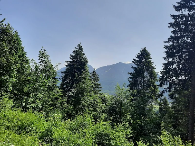
The perhaps strongest search impulse behind Kramer Plateau Path photos is the view itself. Official pages describe the path as a panoramic path with great views of the town and the surrounding mountains. Specifically mentioned are Wetterstein, Karwendel, and Ester mountain ranges, which are exactly the landscapes that many guests associate with Garmisch-Partenkirchen. The path lies at the foot of the Kramer and runs at a height that does not require alpine climbing but still conveys the feeling of being significantly above the valley. This is scenically attractive without being intimidating. In practice, this means: There are many open perspectives, clearings, forest passages, and moments where the view opens up to the town or the mountains. It is precisely these changes that make the path photogenic. ([zugspitz-region.de](https://www.zugspitz-region.de/tour/kramerplateauweg))
Particularly strong is the path near the Kriegergedächtniskapelle, the Almhütte, and Pflegersee. The official pages not only mention these stations but highlight them as real highlights. Additionally, there is seasonal diversity: In spring, early bloomers appear, in summer, flower meadows, in autumn, the rustling of leaves, and in winter, the quiet, white landscape. The GaPa page explicitly emphasizes that the Kramer Plateau Path is an experience in every season. So, those who want to take photos will find not only a standard motif but also very different moods depending on the season. This also explains why the path is documented with numerous images on tour pages: AllTrails lists 125 photos for one route, while Komoot has significantly larger image collections on its tour pages. ([gapa-tourismus.de](https://www.gapa-tourismus.de/de/Sommer/Ausfl%C3%BCge/Sehensw%C3%BCrdigkeiten/Kramerplateauweg))
The character of the path itself also contributes to the visual impact. The route is considered well-developed and family-friendly, which means: One does not walk in constant ups and downs but rather flows smoothly through forests, meadows, and viewpoints. This leads to very different motifs in a small area. Additionally, the immediate surroundings offer further motifs, such as the view of Garmisch-Partenkirchen with the ski jump, the meadows along the Kramer Plateau Path, or the view from the valley to the chapel terrace. Therefore, those looking for photos benefit from a path that not only provides a single postcard motif but a whole series of intermediate images. This is exactly what makes the route particularly interesting for social media, family photos, and relaxed hiking pictures. ([gapa-tourismus.de](https://www.gapa-tourismus.de/de/Sommer/Ausfl%C3%BCge/Sehensw%C3%BCrdigkeiten/Kramerplateauweg))
Kriegergedächtniskapelle, Pflegersee, and Almhütte: The Most Important Stations
The Kriegergedächtniskapelle is one of the most distinctive stations on the Kramer Plateau Path and historically perhaps the most important place on the route. The official GaPa page explains that it was built in 1952 in memory of the fallen and missing of World War II below the mountain inn St. Martin. It stands on the plateau northwest of Garmisch-Partenkirchen at the foot of the Kramer and was erected by Hans Ostler. Several memorial stones and a stone altar with a large wooden cross surround the chapel. For many hikers, this is a quiet moment on an otherwise scenically dominated route. The chapel gives the path a depth of content that goes beyond a mere panoramic walk. ([gapa-tourismus.de](https://www.gapa-tourismus.de/de/Sommer/Ausfl%C3%BCge/Sehensw%C3%BCrdigkeiten/Kramerplateauweg))
The mountain inn Almhütte, also known as Windbeutelalm, forms the culinary counterpart to this. In the official descriptions, it is mentioned as a stop directly on the path, and the region's blog explicitly refers to its sweet and savory windbeutel variations. This combination of remembrance, views, and refreshment is typical for the Kramer Plateau Path. Those who hike can stop in between, have something to eat or drink, and then continue the route at a leisurely pace. Additionally, there is a Kneipp basin along the way, which is freely accessible in summer, as well as Pflegersee nearby. For guests who want to experience their tour rather than just walk, this mix of nature, regional cuisine, and small wellness stations is an essential part of the appeal. ([zugspitz-region.de](https://www.zugspitz-region.de/poi/kneippbecken-am-kramerplateauweg?utm_source=openai))
Pflegersee itself is not only a starting or endpoint but also part of the scenic context. Official tours describe that the Kramer Plateau Path can lead past the lake or start from there. It is also mentioned as a place where a break is recommended. Those who choose the longer variant thus experience a connection of place, plateau, chapel, hut, and lake. The proximity of Schmölzersee and the Werdenfels castle ruins is also emphasized. This makes the Kramer Plateau Path almost like a band connecting several small destinations. This is exactly what makes it so interesting for search queries that look for not only the path itself but also for excursion destinations in the surrounding area. ([gapa-tourismus.de](https://www.gapa-tourismus.de/blog/artikel/Kramerplateauweg-Wanderungen-Ausflugsziele-und-Einkehrmoeglichkeiten-an-GaPas-schoenstem-Panoramaweg-/643))
Reviews, Difficulty, and Practical Tips for the Tour
Those searching for Kramer Plateau Path reviews usually want to know if the path is really as pleasant as the descriptions promise. The answer is: yes, at least for most recreational hikers. The official tour rates the difficulty as easy and the physical condition as also easy, while the route above Garmisch-Partenkirchen is described as a circular path with great panorama. AllTrails rates a Kramer Plateau Path variant with 4.5 stars based on 48 reviews, while Komoot lists a route with 4.8 stars based on 32 reviews. Together, this paints a picture of a popular, well-received panoramic path that not only sounds good in brochures but is actually regularly positively rated on hiking platforms. ([zugspitz-region.de](https://www.zugspitz-region.de/tour/kramerplateauweg))
Everyday usability also plays a role. The official GaPa page describes the route as stroller-friendly, and the Zugspitz Region emphasizes that the path runs without significant inclines. This is a real plus for families, leisurely hikers, and anyone who prefers to be relaxed rather than sporty. Additionally, practical tips such as wearing good footwear, dressing in layers, and bringing some provisions and drinks are recommended. Those who undertake the tour in summer benefit from shady sections and the Kneipp basin; in winter, the route offers quiet landscapes and clear views. However, for realistic planning, it is still important to note: The path is easy but not trivial. Especially in wet conditions, snow, or longer variants, one should pay attention to the weather and carefully consider which entry point to choose beforehand. ([zugspitz-region.de](https://www.zugspitz-region.de/tour/oberhalb-von-garmisch-partenkirchen-auf-dem-kramerplateauweg))
In practice, the Kramer Plateau Path is therefore a very versatile choice. It works as a short panoramic walk, as a family-friendly loop, as part of a larger hike, or as a connection between Garmisch-Partenkirchen and Grainau. Those who combine review stars, photos, maps, and parking in one search usually seek exactly this mix of reliability and experience. The Kramer Plateau Path delivers both: good infrastructure, clear signage, several official starting points, and real highlights along the way. The fact that the route has regularly appeared in official tour suggestions for years and is also well documented on major hiking platforms underscores the practical value of this route. For visitors looking for a manageable, scenic, and varied hike in Garmisch-Partenkirchen, the Kramer Plateau Path remains one of the best addresses. ([zugspitz-region.de](https://www.zugspitz-region.de/tour/kramerplateauweg))
Sources:
- GaPa Tourism GmbH – Kramer Plateau Path
- Zugspitz Region – Kramer Plateau Path
- Zugspitz Region – Above Garmisch-Partenkirchen on the Kramer Plateau Path
- Zugspitz Region – Parking Lot Wittelsbacher Park P1
- GaPa Tourism Blog – Kramer Plateau Path: Hikes, Excursion Destinations, and Refreshment Options
- AllTrails – Kramer Plateau Path - Almhütte
- Komoot – Kramer Plateau Path and Kramer Plateau Path
Mehr anzeigenWeniger anzeigen
Kramer Plateau Path Garmisch Partenkirchen | Map & Parking
The Kramer Plateau Path is one of those trails where the first few meters show why it is so frequently sought after: It connects the proximity to the town with a true mountain atmosphere, remains relatively easy to walk, and still offers wide views of the alpine landscape around Garmisch-Partenkirchen. Official tours describe it as a panoramic path at the foot of the Kramer, with sections that run without significant inclines and can be taken as a circular route or a longer connection to Grainau, depending on the variant. This mix of accessibility, views, and several possible entry points is what makes the Kramer Plateau Path appealing. Those looking for maps, parking, photos, or reviews usually want exactly that: clear orientation, real highlights along the way, and a realistic assessment of whether the tour fits their schedule. The Kramer Plateau Path meets these expectations very well, as it is not only scenically attractive but also practically well documented. ([zugspitz-region.de](https://www.zugspitz-region.de/tour/kramerplateauweg))
Map and Route: How to Navigate the Kramer Plateau Path
When searching for the map of the Kramer Plateau Path, the official tours from the Zugspitz Region and GaPa Tourism are particularly helpful, as they not only describe the path but also provide starting points, route details, and GPX downloads. An official variant starts at the Farchant train station or at the Lanewies P3 parking lot or the parking lot at Pflegersee, leading as a 13.00-kilometer tour to Grainau. Another official loop above Garmisch-Partenkirchen begins at Richard-Strauss-Platz, crosses the Loisach Bridge, and follows Kramerstraße to the plateau hiking trail and back as a 7.11-kilometer circular route. This is important for practical planning because the search term map often does not only refer to a visual overview but also to the question: Where do I start, how long will the route be, and can I shorten it along the way? The official routes provide clear answers to exactly that. ([zugspitz-region.de](https://www.zugspitz-region.de/tour/kramerplateauweg))
The route descriptions also show that the Kramer Plateau Path can be used flexibly. Those who only want to take a scenic walk can choose a short section and return the same way later. Those with more time can extend the path to include Pflegersee, the Kriegergedächtniskapelle, or a detour to the mountain hut. The official description even mentions that the tour can easily be shortened or extended. This is crucial for many search queries related to Kramer Plateau Path map, Garmisch, and route, as it means one does not have to improvise on-site. It is also particularly useful that the path is described in the official material as well-marked. This makes navigation easy despite several connection options, as long as one briefly looks at the chosen entry version beforehand. ([zugspitz-region.de](https://www.zugspitz-region.de/tour/kramerplateauweg))
Another advantage of the map is the context of the path within its surroundings. The Kramer Plateau Path runs along the southern slope of the Kramer and offers views of the Ester, Karwendel, and Wetterstein mountain ranges. The official GaPa page also emphasizes that the Kriegergedächtniskapelle, Schmölzersee, and Pflegersee are located in close proximity. So, when planning with a map, one quickly sees: The path is not an isolated walk but a connecting piece between several excursion destinations. This makes it ideal for guests who not only want to walk but also want to stop, look, and take a break along the way. ([zugspitz-region.de](https://www.zugspitz-region.de/tour/kramerplateauweg))
Parking and Access: The Best Starting Points Around Garmisch-Partenkirchen
Regarding parking, the Kramer Plateau Path offers several realistic options, depending on how long the hike is intended to be. For the circular tour above Garmisch-Partenkirchen, the official tour names the parking lot at Wittelsbacher Park P1 and P2 as starting points. This paid parking lot is located right next to the Michael-Ende-Kurpark and just a few minutes' walk from the pedestrian zone and tourist information. This is particularly convenient if one wants to walk through the town to the entry point first and then connect to the nature route. For many search queries related to Kramer Plateau Path parking, this is the most important information: park centrally, start comfortably, and reach the actual path on foot. ([zugspitz-region.de](https://www.zugspitz-region.de/poi/parkplatz-wittelsbacher-park-p1))
For those who want to drive directly towards the plateau, the official description states that one can drive through Garmisch to Pflegersee and park there. A second option is described by the GaPa blog: Those who are not good on foot or want to enjoy the panorama without much effort can park at Maximilianshöhe at the mountain inn Almhütte and hike from there towards Pflegersee. These starting points are particularly interesting when the path is intended as a relaxed panoramic walk rather than a longer hike. For the route via the Kramer Plateau Path, it is also noted: Depending on the choice, one can combine either the proximity to the town, access to the lake, or the higher entry at the Almhütte from the parking lot. This makes access flexible and explains why the search for parking and access is so closely linked to this path. ([zugspitz-region.de](https://www.zugspitz-region.de/tour/kramerplateauweg))
Even without a car, the Kramer Plateau Path is easily accessible. The official tour from Garmisch mentions arriving by train to Garmisch-Partenkirchen station and additionally taking the local bus to Loisach Bridge. In the Farchant variant, it is also emphasized that starting at the train station is easily possible and one can comfortably begin the tour via public transport. For guests who consciously plan their hike sustainably, this is a strong argument. Especially for a path that works both as a circular route and as a longer panoramic connection, the combination of train, local bus, and walking is particularly helpful. This way, the tour can be well planned regardless of parking search and daily condition. ([zugspitz-region.de](https://www.zugspitz-region.de/tour/oberhalb-von-garmisch-partenkirchen-auf-dem-kramerplateauweg))
Panorama, Photos, and Highlights: What You Will Really See Along the Way
The perhaps strongest search impulse behind Kramer Plateau Path photos is the view itself. Official pages describe the path as a panoramic path with great views of the town and the surrounding mountains. Specifically mentioned are Wetterstein, Karwendel, and Ester mountain ranges, which are exactly the landscapes that many guests associate with Garmisch-Partenkirchen. The path lies at the foot of the Kramer and runs at a height that does not require alpine climbing but still conveys the feeling of being significantly above the valley. This is scenically attractive without being intimidating. In practice, this means: There are many open perspectives, clearings, forest passages, and moments where the view opens up to the town or the mountains. It is precisely these changes that make the path photogenic. ([zugspitz-region.de](https://www.zugspitz-region.de/tour/kramerplateauweg))
Particularly strong is the path near the Kriegergedächtniskapelle, the Almhütte, and Pflegersee. The official pages not only mention these stations but highlight them as real highlights. Additionally, there is seasonal diversity: In spring, early bloomers appear, in summer, flower meadows, in autumn, the rustling of leaves, and in winter, the quiet, white landscape. The GaPa page explicitly emphasizes that the Kramer Plateau Path is an experience in every season. So, those who want to take photos will find not only a standard motif but also very different moods depending on the season. This also explains why the path is documented with numerous images on tour pages: AllTrails lists 125 photos for one route, while Komoot has significantly larger image collections on its tour pages. ([gapa-tourismus.de](https://www.gapa-tourismus.de/de/Sommer/Ausfl%C3%BCge/Sehensw%C3%BCrdigkeiten/Kramerplateauweg))
The character of the path itself also contributes to the visual impact. The route is considered well-developed and family-friendly, which means: One does not walk in constant ups and downs but rather flows smoothly through forests, meadows, and viewpoints. This leads to very different motifs in a small area. Additionally, the immediate surroundings offer further motifs, such as the view of Garmisch-Partenkirchen with the ski jump, the meadows along the Kramer Plateau Path, or the view from the valley to the chapel terrace. Therefore, those looking for photos benefit from a path that not only provides a single postcard motif but a whole series of intermediate images. This is exactly what makes the route particularly interesting for social media, family photos, and relaxed hiking pictures. ([gapa-tourismus.de](https://www.gapa-tourismus.de/de/Sommer/Ausfl%C3%BCge/Sehensw%C3%BCrdigkeiten/Kramerplateauweg))
Kriegergedächtniskapelle, Pflegersee, and Almhütte: The Most Important Stations
The Kriegergedächtniskapelle is one of the most distinctive stations on the Kramer Plateau Path and historically perhaps the most important place on the route. The official GaPa page explains that it was built in 1952 in memory of the fallen and missing of World War II below the mountain inn St. Martin. It stands on the plateau northwest of Garmisch-Partenkirchen at the foot of the Kramer and was erected by Hans Ostler. Several memorial stones and a stone altar with a large wooden cross surround the chapel. For many hikers, this is a quiet moment on an otherwise scenically dominated route. The chapel gives the path a depth of content that goes beyond a mere panoramic walk. ([gapa-tourismus.de](https://www.gapa-tourismus.de/de/Sommer/Ausfl%C3%BCge/Sehensw%C3%BCrdigkeiten/Kramerplateauweg))
The mountain inn Almhütte, also known as Windbeutelalm, forms the culinary counterpart to this. In the official descriptions, it is mentioned as a stop directly on the path, and the region's blog explicitly refers to its sweet and savory windbeutel variations. This combination of remembrance, views, and refreshment is typical for the Kramer Plateau Path. Those who hike can stop in between, have something to eat or drink, and then continue the route at a leisurely pace. Additionally, there is a Kneipp basin along the way, which is freely accessible in summer, as well as Pflegersee nearby. For guests who want to experience their tour rather than just walk, this mix of nature, regional cuisine, and small wellness stations is an essential part of the appeal. ([zugspitz-region.de](https://www.zugspitz-region.de/poi/kneippbecken-am-kramerplateauweg?utm_source=openai))
Pflegersee itself is not only a starting or endpoint but also part of the scenic context. Official tours describe that the Kramer Plateau Path can lead past the lake or start from there. It is also mentioned as a place where a break is recommended. Those who choose the longer variant thus experience a connection of place, plateau, chapel, hut, and lake. The proximity of Schmölzersee and the Werdenfels castle ruins is also emphasized. This makes the Kramer Plateau Path almost like a band connecting several small destinations. This is exactly what makes it so interesting for search queries that look for not only the path itself but also for excursion destinations in the surrounding area. ([gapa-tourismus.de](https://www.gapa-tourismus.de/blog/artikel/Kramerplateauweg-Wanderungen-Ausflugsziele-und-Einkehrmoeglichkeiten-an-GaPas-schoenstem-Panoramaweg-/643))
Reviews, Difficulty, and Practical Tips for the Tour
Those searching for Kramer Plateau Path reviews usually want to know if the path is really as pleasant as the descriptions promise. The answer is: yes, at least for most recreational hikers. The official tour rates the difficulty as easy and the physical condition as also easy, while the route above Garmisch-Partenkirchen is described as a circular path with great panorama. AllTrails rates a Kramer Plateau Path variant with 4.5 stars based on 48 reviews, while Komoot lists a route with 4.8 stars based on 32 reviews. Together, this paints a picture of a popular, well-received panoramic path that not only sounds good in brochures but is actually regularly positively rated on hiking platforms. ([zugspitz-region.de](https://www.zugspitz-region.de/tour/kramerplateauweg))
Everyday usability also plays a role. The official GaPa page describes the route as stroller-friendly, and the Zugspitz Region emphasizes that the path runs without significant inclines. This is a real plus for families, leisurely hikers, and anyone who prefers to be relaxed rather than sporty. Additionally, practical tips such as wearing good footwear, dressing in layers, and bringing some provisions and drinks are recommended. Those who undertake the tour in summer benefit from shady sections and the Kneipp basin; in winter, the route offers quiet landscapes and clear views. However, for realistic planning, it is still important to note: The path is easy but not trivial. Especially in wet conditions, snow, or longer variants, one should pay attention to the weather and carefully consider which entry point to choose beforehand. ([zugspitz-region.de](https://www.zugspitz-region.de/tour/oberhalb-von-garmisch-partenkirchen-auf-dem-kramerplateauweg))
In practice, the Kramer Plateau Path is therefore a very versatile choice. It works as a short panoramic walk, as a family-friendly loop, as part of a larger hike, or as a connection between Garmisch-Partenkirchen and Grainau. Those who combine review stars, photos, maps, and parking in one search usually seek exactly this mix of reliability and experience. The Kramer Plateau Path delivers both: good infrastructure, clear signage, several official starting points, and real highlights along the way. The fact that the route has regularly appeared in official tour suggestions for years and is also well documented on major hiking platforms underscores the practical value of this route. For visitors looking for a manageable, scenic, and varied hike in Garmisch-Partenkirchen, the Kramer Plateau Path remains one of the best addresses. ([zugspitz-region.de](https://www.zugspitz-region.de/tour/kramerplateauweg))
Sources:
- GaPa Tourism GmbH – Kramer Plateau Path
- Zugspitz Region – Kramer Plateau Path
- Zugspitz Region – Above Garmisch-Partenkirchen on the Kramer Plateau Path
- Zugspitz Region – Parking Lot Wittelsbacher Park P1
- GaPa Tourism Blog – Kramer Plateau Path: Hikes, Excursion Destinations, and Refreshment Options
- AllTrails – Kramer Plateau Path - Almhütte
- Komoot – Kramer Plateau Path and Kramer Plateau Path
Kramer Plateau Path Garmisch Partenkirchen | Map & Parking
The Kramer Plateau Path is one of those trails where the first few meters show why it is so frequently sought after: It connects the proximity to the town with a true mountain atmosphere, remains relatively easy to walk, and still offers wide views of the alpine landscape around Garmisch-Partenkirchen. Official tours describe it as a panoramic path at the foot of the Kramer, with sections that run without significant inclines and can be taken as a circular route or a longer connection to Grainau, depending on the variant. This mix of accessibility, views, and several possible entry points is what makes the Kramer Plateau Path appealing. Those looking for maps, parking, photos, or reviews usually want exactly that: clear orientation, real highlights along the way, and a realistic assessment of whether the tour fits their schedule. The Kramer Plateau Path meets these expectations very well, as it is not only scenically attractive but also practically well documented. ([zugspitz-region.de](https://www.zugspitz-region.de/tour/kramerplateauweg))
Map and Route: How to Navigate the Kramer Plateau Path
When searching for the map of the Kramer Plateau Path, the official tours from the Zugspitz Region and GaPa Tourism are particularly helpful, as they not only describe the path but also provide starting points, route details, and GPX downloads. An official variant starts at the Farchant train station or at the Lanewies P3 parking lot or the parking lot at Pflegersee, leading as a 13.00-kilometer tour to Grainau. Another official loop above Garmisch-Partenkirchen begins at Richard-Strauss-Platz, crosses the Loisach Bridge, and follows Kramerstraße to the plateau hiking trail and back as a 7.11-kilometer circular route. This is important for practical planning because the search term map often does not only refer to a visual overview but also to the question: Where do I start, how long will the route be, and can I shorten it along the way? The official routes provide clear answers to exactly that. ([zugspitz-region.de](https://www.zugspitz-region.de/tour/kramerplateauweg))
The route descriptions also show that the Kramer Plateau Path can be used flexibly. Those who only want to take a scenic walk can choose a short section and return the same way later. Those with more time can extend the path to include Pflegersee, the Kriegergedächtniskapelle, or a detour to the mountain hut. The official description even mentions that the tour can easily be shortened or extended. This is crucial for many search queries related to Kramer Plateau Path map, Garmisch, and route, as it means one does not have to improvise on-site. It is also particularly useful that the path is described in the official material as well-marked. This makes navigation easy despite several connection options, as long as one briefly looks at the chosen entry version beforehand. ([zugspitz-region.de](https://www.zugspitz-region.de/tour/kramerplateauweg))
Another advantage of the map is the context of the path within its surroundings. The Kramer Plateau Path runs along the southern slope of the Kramer and offers views of the Ester, Karwendel, and Wetterstein mountain ranges. The official GaPa page also emphasizes that the Kriegergedächtniskapelle, Schmölzersee, and Pflegersee are located in close proximity. So, when planning with a map, one quickly sees: The path is not an isolated walk but a connecting piece between several excursion destinations. This makes it ideal for guests who not only want to walk but also want to stop, look, and take a break along the way. ([zugspitz-region.de](https://www.zugspitz-region.de/tour/kramerplateauweg))
Parking and Access: The Best Starting Points Around Garmisch-Partenkirchen
Regarding parking, the Kramer Plateau Path offers several realistic options, depending on how long the hike is intended to be. For the circular tour above Garmisch-Partenkirchen, the official tour names the parking lot at Wittelsbacher Park P1 and P2 as starting points. This paid parking lot is located right next to the Michael-Ende-Kurpark and just a few minutes' walk from the pedestrian zone and tourist information. This is particularly convenient if one wants to walk through the town to the entry point first and then connect to the nature route. For many search queries related to Kramer Plateau Path parking, this is the most important information: park centrally, start comfortably, and reach the actual path on foot. ([zugspitz-region.de](https://www.zugspitz-region.de/poi/parkplatz-wittelsbacher-park-p1))
For those who want to drive directly towards the plateau, the official description states that one can drive through Garmisch to Pflegersee and park there. A second option is described by the GaPa blog: Those who are not good on foot or want to enjoy the panorama without much effort can park at Maximilianshöhe at the mountain inn Almhütte and hike from there towards Pflegersee. These starting points are particularly interesting when the path is intended as a relaxed panoramic walk rather than a longer hike. For the route via the Kramer Plateau Path, it is also noted: Depending on the choice, one can combine either the proximity to the town, access to the lake, or the higher entry at the Almhütte from the parking lot. This makes access flexible and explains why the search for parking and access is so closely linked to this path. ([zugspitz-region.de](https://www.zugspitz-region.de/tour/kramerplateauweg))
Even without a car, the Kramer Plateau Path is easily accessible. The official tour from Garmisch mentions arriving by train to Garmisch-Partenkirchen station and additionally taking the local bus to Loisach Bridge. In the Farchant variant, it is also emphasized that starting at the train station is easily possible and one can comfortably begin the tour via public transport. For guests who consciously plan their hike sustainably, this is a strong argument. Especially for a path that works both as a circular route and as a longer panoramic connection, the combination of train, local bus, and walking is particularly helpful. This way, the tour can be well planned regardless of parking search and daily condition. ([zugspitz-region.de](https://www.zugspitz-region.de/tour/oberhalb-von-garmisch-partenkirchen-auf-dem-kramerplateauweg))
Panorama, Photos, and Highlights: What You Will Really See Along the Way
The perhaps strongest search impulse behind Kramer Plateau Path photos is the view itself. Official pages describe the path as a panoramic path with great views of the town and the surrounding mountains. Specifically mentioned are Wetterstein, Karwendel, and Ester mountain ranges, which are exactly the landscapes that many guests associate with Garmisch-Partenkirchen. The path lies at the foot of the Kramer and runs at a height that does not require alpine climbing but still conveys the feeling of being significantly above the valley. This is scenically attractive without being intimidating. In practice, this means: There are many open perspectives, clearings, forest passages, and moments where the view opens up to the town or the mountains. It is precisely these changes that make the path photogenic. ([zugspitz-region.de](https://www.zugspitz-region.de/tour/kramerplateauweg))
Particularly strong is the path near the Kriegergedächtniskapelle, the Almhütte, and Pflegersee. The official pages not only mention these stations but highlight them as real highlights. Additionally, there is seasonal diversity: In spring, early bloomers appear, in summer, flower meadows, in autumn, the rustling of leaves, and in winter, the quiet, white landscape. The GaPa page explicitly emphasizes that the Kramer Plateau Path is an experience in every season. So, those who want to take photos will find not only a standard motif but also very different moods depending on the season. This also explains why the path is documented with numerous images on tour pages: AllTrails lists 125 photos for one route, while Komoot has significantly larger image collections on its tour pages. ([gapa-tourismus.de](https://www.gapa-tourismus.de/de/Sommer/Ausfl%C3%BCge/Sehensw%C3%BCrdigkeiten/Kramerplateauweg))
The character of the path itself also contributes to the visual impact. The route is considered well-developed and family-friendly, which means: One does not walk in constant ups and downs but rather flows smoothly through forests, meadows, and viewpoints. This leads to very different motifs in a small area. Additionally, the immediate surroundings offer further motifs, such as the view of Garmisch-Partenkirchen with the ski jump, the meadows along the Kramer Plateau Path, or the view from the valley to the chapel terrace. Therefore, those looking for photos benefit from a path that not only provides a single postcard motif but a whole series of intermediate images. This is exactly what makes the route particularly interesting for social media, family photos, and relaxed hiking pictures. ([gapa-tourismus.de](https://www.gapa-tourismus.de/de/Sommer/Ausfl%C3%BCge/Sehensw%C3%BCrdigkeiten/Kramerplateauweg))
Kriegergedächtniskapelle, Pflegersee, and Almhütte: The Most Important Stations
The Kriegergedächtniskapelle is one of the most distinctive stations on the Kramer Plateau Path and historically perhaps the most important place on the route. The official GaPa page explains that it was built in 1952 in memory of the fallen and missing of World War II below the mountain inn St. Martin. It stands on the plateau northwest of Garmisch-Partenkirchen at the foot of the Kramer and was erected by Hans Ostler. Several memorial stones and a stone altar with a large wooden cross surround the chapel. For many hikers, this is a quiet moment on an otherwise scenically dominated route. The chapel gives the path a depth of content that goes beyond a mere panoramic walk. ([gapa-tourismus.de](https://www.gapa-tourismus.de/de/Sommer/Ausfl%C3%BCge/Sehensw%C3%BCrdigkeiten/Kramerplateauweg))
The mountain inn Almhütte, also known as Windbeutelalm, forms the culinary counterpart to this. In the official descriptions, it is mentioned as a stop directly on the path, and the region's blog explicitly refers to its sweet and savory windbeutel variations. This combination of remembrance, views, and refreshment is typical for the Kramer Plateau Path. Those who hike can stop in between, have something to eat or drink, and then continue the route at a leisurely pace. Additionally, there is a Kneipp basin along the way, which is freely accessible in summer, as well as Pflegersee nearby. For guests who want to experience their tour rather than just walk, this mix of nature, regional cuisine, and small wellness stations is an essential part of the appeal. ([zugspitz-region.de](https://www.zugspitz-region.de/poi/kneippbecken-am-kramerplateauweg?utm_source=openai))
Pflegersee itself is not only a starting or endpoint but also part of the scenic context. Official tours describe that the Kramer Plateau Path can lead past the lake or start from there. It is also mentioned as a place where a break is recommended. Those who choose the longer variant thus experience a connection of place, plateau, chapel, hut, and lake. The proximity of Schmölzersee and the Werdenfels castle ruins is also emphasized. This makes the Kramer Plateau Path almost like a band connecting several small destinations. This is exactly what makes it so interesting for search queries that look for not only the path itself but also for excursion destinations in the surrounding area. ([gapa-tourismus.de](https://www.gapa-tourismus.de/blog/artikel/Kramerplateauweg-Wanderungen-Ausflugsziele-und-Einkehrmoeglichkeiten-an-GaPas-schoenstem-Panoramaweg-/643))
Reviews, Difficulty, and Practical Tips for the Tour
Those searching for Kramer Plateau Path reviews usually want to know if the path is really as pleasant as the descriptions promise. The answer is: yes, at least for most recreational hikers. The official tour rates the difficulty as easy and the physical condition as also easy, while the route above Garmisch-Partenkirchen is described as a circular path with great panorama. AllTrails rates a Kramer Plateau Path variant with 4.5 stars based on 48 reviews, while Komoot lists a route with 4.8 stars based on 32 reviews. Together, this paints a picture of a popular, well-received panoramic path that not only sounds good in brochures but is actually regularly positively rated on hiking platforms. ([zugspitz-region.de](https://www.zugspitz-region.de/tour/kramerplateauweg))
Everyday usability also plays a role. The official GaPa page describes the route as stroller-friendly, and the Zugspitz Region emphasizes that the path runs without significant inclines. This is a real plus for families, leisurely hikers, and anyone who prefers to be relaxed rather than sporty. Additionally, practical tips such as wearing good footwear, dressing in layers, and bringing some provisions and drinks are recommended. Those who undertake the tour in summer benefit from shady sections and the Kneipp basin; in winter, the route offers quiet landscapes and clear views. However, for realistic planning, it is still important to note: The path is easy but not trivial. Especially in wet conditions, snow, or longer variants, one should pay attention to the weather and carefully consider which entry point to choose beforehand. ([zugspitz-region.de](https://www.zugspitz-region.de/tour/oberhalb-von-garmisch-partenkirchen-auf-dem-kramerplateauweg))
In practice, the Kramer Plateau Path is therefore a very versatile choice. It works as a short panoramic walk, as a family-friendly loop, as part of a larger hike, or as a connection between Garmisch-Partenkirchen and Grainau. Those who combine review stars, photos, maps, and parking in one search usually seek exactly this mix of reliability and experience. The Kramer Plateau Path delivers both: good infrastructure, clear signage, several official starting points, and real highlights along the way. The fact that the route has regularly appeared in official tour suggestions for years and is also well documented on major hiking platforms underscores the practical value of this route. For visitors looking for a manageable, scenic, and varied hike in Garmisch-Partenkirchen, the Kramer Plateau Path remains one of the best addresses. ([zugspitz-region.de](https://www.zugspitz-region.de/tour/kramerplateauweg))
Sources:
- GaPa Tourism GmbH – Kramer Plateau Path
- Zugspitz Region – Kramer Plateau Path
- Zugspitz Region – Above Garmisch-Partenkirchen on the Kramer Plateau Path
- Zugspitz Region – Parking Lot Wittelsbacher Park P1
- GaPa Tourism Blog – Kramer Plateau Path: Hikes, Excursion Destinations, and Refreshment Options
- AllTrails – Kramer Plateau Path - Almhütte
- Komoot – Kramer Plateau Path and Kramer Plateau Path
Upcoming Events
No events found
Frequently Asked Questions
Reviews
Fazli Kamaruddin
29. November 2024
Great hiking spot. Not too difficult, considering my 13 and 7 year old daughters and 11 year old son could manage themselves. Beautiful view overlooking the town.
Sirid B
31. July 2025
A really nice hiking/walking path, especially great for families: you can easily walk here with a stroller and can go as far as you want/just turn back or take a detour. Still, you have a very nice view, both of the path itself and the mountain panorama.
Jens Limpek
15. August 2025
Dreamy beautiful hiking trail above Garmisch. Very pleasant to walk and just enjoy.
Lena
6. January 2026
Nice flat hiking trail with a great view of Garmisch-Partenkirchen and the mountains 👍🥾
Kai Amelung
16. July 2023
A very nice hiking trail with great viewpoints of Garmisch and Partenkirchen. The paths are well developed, well signposted, and there are plenty of benches and covered seating areas.